
HPA Tech Retreat: Drones, Photogrammetry as Useful Tools
February 19, 2019
Singularity Imaging founder/chief executive Eric Pohl discussed how drones and photogrammetry methods can be used to extract 3D information and create large point-cloud scenes. Uses include previsualization for production, content for set extensions, VR/AR and gaming applications. Pohl noted that, at last year’s HPA Tech Retreat, a presentation showed how the Unity game engine could be used to map and plan a production. “Mapping and remote sensing are quite mature, but drones bring something new to it,” he noted.
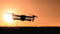
Pohl explained that, “UAV [unmanned aerial vehicle] photogrammetry will allow low cost low altitude flights with a possibility of a higher ground pixel density at 400 feet and below.”
“There are many choices for camera payload,” he said. “Mission planning is important to define a path of the autonomous flight over the terrain or structure.”
Imaging considerations include a large depth of field and GPS tagging. “If you have a drone with an integrated camera, when it takes a picture, the GPS coordinates are embedded in the image EXIF [exchangeable image file format] data,” he explained. “If you use a non-integrated camera, you extract shot locations and insert them into EXIF data.”
He noted that GPS correction technology — with real-time kinematic (RTK) or post processed kinematic (PPK), which requires an extra ground-based GPS station — will give the user “a millimeter level position accuracy.”
The growth of UAVs, said Pohl, is due to “low cost GPS, 6DOF sensors, battery technology and efficient motors.” “With regard to software, there’s been a lot of advancement in robotics, feedback theory, digital filtering and sensor fusion,” he added. He noted that UAVs in question include those from 0.5 to 55 pounds.
Photogrammetry, the science of making measurements/maps from photographs, produces an orthophotograph, geometrically corrected for lens distortion and acquisition angle; an orthomosaic is a composite image of orthophotographs, aligned with latitude and longitude. In the early days of photogrammetry, he added, the first 3D maps were created using a stereoplotter, which relied on stereo photos to determine elevations, but required a human operator.
Now, people rely on DSMs (digital surface models), available in the public domain, that are constructed algorithmically from a series of digital photographs. A 3D representation can be drawn from an analysis of aerial photographs; airborne Lidar and InSAR are also used to provide digital terrain information.
“In the digital age, remote sensing industry is huge and there have been lots of advantages and many new photogrammetry applications and platforms,” said Pohl. “As we push the density of depth information, what’s new is that UAVs can leverage this and bring this to low altitude acquisition.”
No Comments Yet
You can be the first to comment!
Sorry, comments for this entry are closed at this time.