Google Maps Goes Off Road with Impressive Trekker Project
February 8, 2013
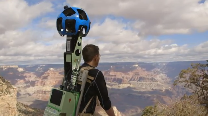
Google announced plans for its Trekker project last October. And last week, it revealed the first results with “some of the most detailed and amazing interactive imagery of the Grand Canyon, as promised, showing off Google’s vision for how the world can be catalogued and detailed for everyone’s daily tasks and travels,” writes TechCrunch. These images are now showing up on Google Maps for public availability.
 “This breathtaking imagery collection was made possible with the Trekker,” explains a Google Maps blog post. “Our team strapped on the Android-operated 40-pound backpacks carrying the 15-lens camera system and wound along the rocky terrain on foot, enduring temperature swings and a few muscle cramps along the way. Together, more than 9,500 panoramas of this masterpiece of nature are now available on Google Maps.”
“The idea of Trekker is that there are so many views and vantage points that you can’t capture simply by driving a Street View vehicle up and down roads. There are places that cars and trucks can’t go, and this is where Trekker comes into play,” reports TechCrunch.
Trekker is not yet a consumer device, but will likely be used by Google to collect more images. The article even suggests the possibility of integration with Street View technology if it becomes available for Google Glass. “Google wants people to feel like they’re Christopher Columbus, exploring areas in ways that nobody else ever has, while documenting their experiences along the way. There could be a nice cozy spot at the Grand Canyon that only you know about, and you could be the first person to take an image of it for Google Maps with something like Trekker or Glass.”
The post includes a collection of Grand Canyon photos and video captured with Trekker.

No Comments Yet
You can be the first to comment!
Leave a comment
You must be logged in to post a comment.